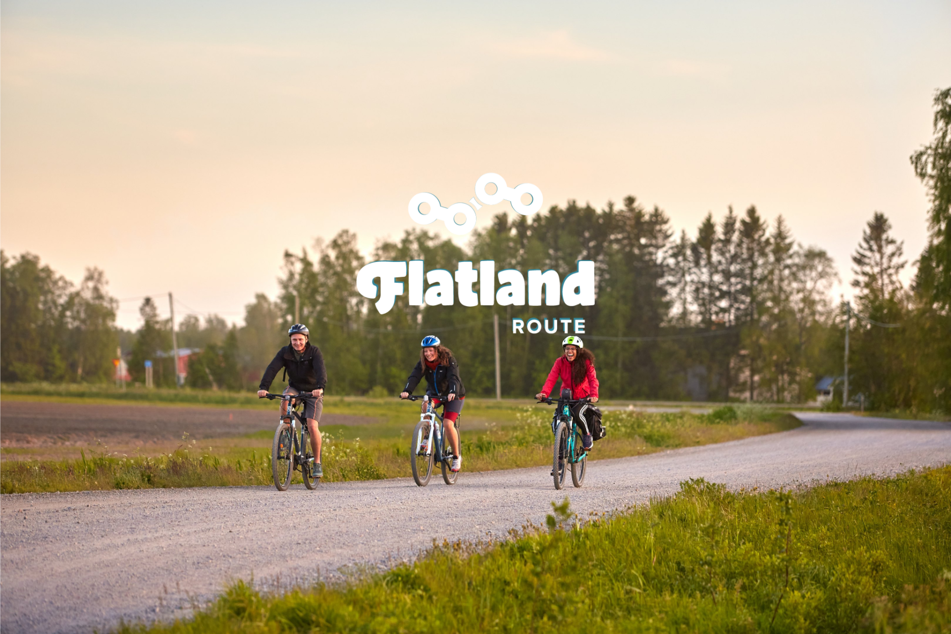
The Flatland Route is a flat and easy-to-ride cycling route along the Baltic Sea coast in Northern Ostrobothnia. Dominated by gravel roads, the circular route spans 320 kilometers and typically takes five to six days to complete by bike. The Flatland Route connects the villages, towns, nature reserves, historical sites, and services along the southeastern coast of the Gulf of Bothnia via low-traffic side roads. It offers an interesting and diverse journey through the area's nature and history!
Distance

320 km
Duration

5–6 days
Elevation gain

770 m
Highest point

126 m
Difficulty

3/10
Dirt road

55 %
Trails

1 %
Bikeable

100 %
The Flatland Route is a versatile cycling route suitable for beginners, located along the coast of the Gulf of Bothnia and in the inland. The route consists of four different sections. The initial days starting from Liminka traverse flat coastal landscapes, including sandy beaches and harbors, passing through Lumijoki, Siikajoki, Raahe, and Pyhäjoki. Following that, the route continues inland from Pyhäjoki along old embankment roads to Merijärvi and all the way to Oulainen. The return journey northward towards Vihanti passes through the forest, past Vihanti's lean-to shelters and homes. The final stretch of the route, from Ruukki's old industrial environment to Liminka, follows the maintenance roads of the railway.
Apart from the tranquil side roads, gravel paths, and diverse route sections, the charm of the route lies in the tiny villages, where the village atmosphere is reflected in unique and personalized services for travelers. An old retired ship may have found new life as a café and inn on dry land, a schoolyard may be transformed into a summer campground, or an old Art Nouveau mansion or health center may have been renovated into a resting place for travelers. Additionally, the route includes the internationally significant Liminganlahti Nature Reserve and Nature Center, several old churches, tree species parks, some of Finland's oldest bridges, and several museum areas. The route also passes through the Old Town of Raahe, one of Finland's best-preserved 19th-century wooden towns.
The route is easily accessible by public transport: railway stations along the route are located in Oulainen, Raahe-Vihanti, and Siikajoki-Ruukki. From Oulu, you can reach the starting point of Liminka by bus in just over half an hour, and by bike, the starting point is only 30 kilometers away. The route offers a leisurely 5-6 day trip suitable for anyone, whether camping or utilizing accommodation services alone. A speedier cyclist can complete the route much faster, for example, as a three-day weekend trip, weather, condition, and company permitting.
Route highlights
- Idyllic and unique villages with their own special services.
- Tranquil sandy and forest roads that connect the area's services and attractions.
- Endless sandy beaches and numerous harbors along the coast of the Bothnian Sea.
- Pyhäjoki bench roads with their resting areas.
- Countless lean-tos and shelters in the depths of the forests and along the waters.
- Old Town Raahe, one of Finland's best-preserved 19th-century wooden towns.
- Liminganlahti Nature Reserve and Nature Center.
- The abundance of services makes hiking light and easy.
- The lack of hills, especially in the coastal section of the route, makes cycling efficient.
DOWNLOAD ROUTE INFORMATION (opens a new window in Outdooractive.)
The diverse nature of the region also offers numerous other hiking options.
- The route is passable with any bicycle as long as the minimum tire size is 35 mm. There are a few short soft sections on the route, but it might not be necessary to use larger tires because of them.
- The best time for cycling trips in southern Northern Ostrobothnia is usually from late May to the end of September. Daytime temperatures range from 12 to 20 degrees Celsius in early and late summer, and from 15 to 25 degrees Celsius during the summer months.
- When choosing a sleeping bag, it's good to consider that at least in early and late summer, nighttime temperatures can drop below five degrees Celsius.
- During the summer months, days are long and there is light around the clock. If this is new to you, getting used to the light and finding a sleep rhythm may take some time.
- On the route, there is only digital route guidance. Read the instructions and tips for successful route navigation on bikepacking.com here and here. Pay special attention to the battery life of your navigation device and bring along a spare battery or power bank.
- Always stay on the designated route and try to use only the camping and rest areas recommended in the route description. Additionally, follow the guidelines of Metsähallitus for hiking etiquette.
- The mobile phone network covers the entire route area: calling for help is always possible by dialing 112 or using the 112 application.
- It's possible to cycle the route without camping gear at a relaxed daily pace when overnight stays are booked in advance.
- The prices of accommodation services vary from very affordable to moderate.
- Camping is allowed and free at all designated tent sites marked on the map unless it's a paid camping area with services.
- Water is usually not available at recommended camping sites, so carry water from the nearest water point to your campsite for overnight stays.
- Firewood and outhouses are only available at some rest and overnight stops.
- There may not be AirBnB accommodation at all places along the route.
- Restaurants, cafes, and shops are available regularly along the route, but especially outside urban areas, service opening hours may vary greatly depending on the season. Check the service opening hours in advance.
- Typically, you can get by on the route by carrying half a day's worth of provisions and two liters of water. However, for overnight stays, you will likely need to carry more water.
- At lean-tos and shelters, it's important to remember that making open fires is strictly prohibited during a forest fire warning. Information about regional forest fire warnings can be found here.
- Water is usually not available at recommended camping sites, so carry water from the nearest water point to your campsite for overnight stays.
- In Finland, tap water is usually of high quality and drinkable. Restaurants, cafes, kiosks, and shops along the route often gladly refill cyclists' water bottles.
- You can reach the official starting point of the route in Liminka by bus in just over half an hour from Oulu, and buses run regularly throughout the day. It's not possible to reserve a bicycle space in advance, but there's room for bikes if space is available. Since the distance from Oulu to Liminka is only 30 km, you can conveniently reach the route by bike, for example, along this route.
- You can also start the route from Oulainen, which can be reached by train from Helsinki in about five hours, with trains running approximately every hour during the day. It's recommended to reserve a bike space on the train well in advance.
- Ruukki and Vihanti are also accessible by train, but there are fewer daily stops at station.
- Bus connections also operate to Siikajoki, Raahe, and Pyhäjoki.
The route consists mostly of very easy and flat gravel roads, forest paths, and lightly trafficked asphalt roads, making its difficulty level generally low. There are a few technically more challenging sections, such as the Rantakylä trail section and the approach to Lampinsaari, but these are short and easily manageable with a moderate pace.
The first four days of the route to Oulainen and the last two days involve minimal climbing, making progress generally easy. The physical difficulty of the route is rated 2/10 and the technical difficulty 3/10. Regularly spaced services and short distances enhance the ease of travel. Additionally, public transportation can be used to reach the next village if necessary, such as for bike repairs.
Wind conditions may affect the difficulty level, especially the winds along the Bothnian Sea coast, which can make some sections more challenging.
To improve the comfort of cycling, lighter gear is recommended. Although the route is mostly flat, lighter gear makes travel easier. The recommended tire size is a minimum of 35 mm, but experienced cyclists can manage with narrower tires. Except for a few soft sections, larger tires may not be necessary.
Below you'll find the proposed route description in the dropdown boxes.
The Flatland Route begins from the center of Liminka along a paved road that cuts through fields to the tranquility of the Rantakylä recreational area. From the Liminka Bay Nature Center, you can detour right at the beginning of the route by cycling through Jurvalankuja, Seikkulankuja, and Mattilankuja from the Rantakylä recreational area to the bike path along Lumijoki Road, where you'll ride about 100 meters back north. The return to the route is along the same path. As you head towards Lumijoki, the route first turns into a gravel road and soon after into a partially sandy forest path. With narrower tires, you'll need to be careful with the sand at times, but you'll quickly leave behind the sandy plains of Rantakylä. The approximately two-kilometer trail through the depths of the forest is the longest section of the entire route, but it's smooth and quick, not significantly slowing progress.
After passing through the services of Lumijoki, the route follows gravel roads towards the coast of the Gulf of Bothnia, specifically Liminka Bay, whose internationally valuable bird sanctuary is entirely protected as a Natura area. There is a bird watching tower at the bay, and at Sannanlahti's campfire site, there is plenty of space for camping. However, Lumijoki's Varjakka fishing and small boat harbor is only about 10 additional kilometers from Liminka Bay. At the harbor, you'll find the charming Ship Café and Hailuoto Inn, a free camping area, water, a grill hut, showers, and a rental sauna. The distance from Liminka to Varjakka is approximately 32 kilometers.
From Varjakka, an eight-fishing harbor series begins all the way to Siikajoki, where the first day's journey more or less ends. The stretch between Varjakka and Siikajoki begins with a roughly 10-kilometer straight gravel road section and continues on paved roads roughly following the contours of the coastline. The small fishing harbors offer good resting spots and shelter from the rain, from lean-tos to small cabins. In Varessäikä, in addition to the sandy beach, you'll find grilled food, a kiosk, a lean-to, and a hut. At Törmälä Farm, there's an opportunity to camp, but if you prefer cottage accommodation, drive to Siikajoenkylä near the golf course and golf restaurant to stay in the newest holiday cottages.
The second day of the trip is, like the first, characterized by flat and open landscapes of fields and coniferous forests along the coast of the Gulf of Bothnia, with a few visits to the shore. From Siikajoki to Raahe, the route mainly follows lightly trafficked paved roads. Seven kilometers from the road to Raahe is a detour to Tauvo's sandy beach. Cyclists may be tempted to skip Tauvo along the route, but the magnificent sandy beach at the destination will surely reward the effort. Tauvo's beach with its summer kiosk is an excellent place to take a break and refill water supplies before continuing south. You'll also find a campfire site and lean-to at Tauvo. The return to the route is along the same road.
Pattijoen Pizza & Kebab is strategically located just before reaching Raahe at the 44-kilometer mark of the day, making it difficult to pass by, even though the city is only five kilometers away. The stone bridge in Pattijoki, completed in 1987, is the oldest stone arch bridge in Northern Finland and was part of the Oulu–Vaasa route as early as the 17th century. The last kilometers to the nearly 400-year-old city of Raahe and the Old Town of Raahe follow the path of this historic road, although it may not be recognizable as such from the cycle path.
Raahe is the largest settlement along the entire route, offering several dining and accommodation options. The cycling day from Siikajoki to Raahe is perhaps the easiest of the entire route, but the next guesthouses are located far away in Pyhäjoki, so arriving early in the 19th-century wooden city is not a bad idea anyway. Lohenpyrstö Camping before Raahe is the choice for those seeking a tent spot with its beaches and saunas.
The third day along the coast is also easy in terms of distance and elevation gain, but once again, the journey is predominantly on gravel roads. Eight kilometers from Raahe begins a charming series of sandy roads, sometimes shaded by dense deciduous trees, connecting four lean-tos located between Raahe and Pyhäjoki.
The day largely consists of brisk and varied cycling on sandy tracks of various sizes and smooth forest paths. Food stops, and also the only water points of the day, are located at cycling kilometers 5, 10, and 15. Otherwise, the lean-tos serve as convenient rest spots along with the Yli-Mattila Tree Species Park, which is located just before reaching Pyhäjoki.
In Pyhäjoki, you'll find two shops, a couple of restaurant options, and two accommodation options. The first one, Kielosaari Riverside Cottages and Camping, offers cottage accommodation as well as tent spots. For campers, Kielosaari Camping is an easy choice close to the village's amenities, but camping is also possible at Pirttikoski Schoolyard, which provides toilets and a water point for campers. It's about nine kilometers from Pyhäjoki village to Pirttikoski upstream.
The fourth day of the journey is characterized by continuous ascent, at least technically, as the route follows the Pyhäjoki River upstream all the way to Oulainen. The path traverses idyllic and historical bench roads for almost the entire day, making this stage somewhat rare in Finland. There's likely no prettier route from the coast back to the inland.
Pyhänkoski lean-to and kiosk conveniently mark the halfway point of the day, and there's no need to stray far from the route for a visit to Merijärvi's shop either. Closer to Oulainen along the riverbank, several lean-tos are situated at scenic spots for resting, with Petäjäskoski's beach and grill hut being an excellent camping spot.
Culturally interesting accommodation in Oulainen is offered by the over 100-year-old Penttilä House, but there are other lodging options available as well. Two kilometers further from Piipsjärvi is Honkamaja, which offers accommodation and food.
TIP! Oulainen, Vihanti, and Ruukki all have railway stations, providing regular train connections to Oulu and towards Helsinki. Thus, these three serve as alternative starting and ending points for the route, either when arriving by train or if plans change.
On the way back north from Oulainen, the route finally heads towards the starting point of the circular route. The fifth day of cycling to Vihanti utilizes the Vihanti hiking trails – incorporating sandy trail sections, lean-tos, and shelters – creating a portion as wilderness-like as the southern part of Northern Ostrobothnia, dotted with farms and forests, can offer. The lean-tos and shelters are in good condition, and firewood is often available. For those camping, there are several overnight options, with perhaps the most interesting being the Kiviharju Giant Lean-to, offering space for around ten campers in a beautiful fresh coniferous forest.
Although most of the day consists of easy gravel roads, there are also a couple of kilometers of more challenging trails due to connecting the lean-tos and shelters. The Mutterimaja shelter is reached via about a kilometer of soft trail, and from the Kiviharju lean-to, the journey continues for about a kilometer along a path-like ski trail. The route is hillier compared to the relatively flat coastline, but the elevation gain remains relatively minimal.
The old mining village of Lampinsaari offers manor accommodation, a campground, and a café, approximately 35 kilometers from Oulainen. The fifth day of the trip concludes in Vihanti village, where the Vihanti local heritage association offers accommodation on the shores of Kirkkojärvi Lake.
TIP! Oulainen, Vihanti, and Ruukki have railway stations, providing regular train connections to Oulu and towards Helsinki. Thus, these three serve as alternative starting and ending points for the route, either when arriving by train or if plans change.
The theme of the final day of the route is the gravel maintenance roads of the Finnish State Railways, which provide a direct and partially traffic-free cycling connection back to Liminka. The day begins in Vihanti, where you'll make a detour to Mäntylampi Beach and the summer café. The sandy and lightly trafficked roads eventually lead to the charming old industrial village of Ruukki along the banks of the Siikajoki River. In Ruukki, there are restaurant and café options as well as the old factory milieu. Converted from an old health center to a café and inn, Café Ruukin Teekoo is an interesting overnight stop. On hot days, the beach at the Hietamaa Leisure Center with its summer café is an excellent rest spot. Camping is permitted at Hietamaa, and the area also features a lean-to and a grill hut.
From Ruukki, the route continues along forest roads parallel to the railway, followed by the unavoidable challenge: 1.3 kilometers of Raahentie road. Fortunately, this heavily trafficked section passes quickly, and the last kilometers are once again on traffic-free side roads and swift gravel paths. Overall, the final day of cycling is surprisingly interesting, perhaps because it offers a different cycling experience once again. The Liminka old railway station serves as the endpoint of the route, where instead of ticket sales, you can now enjoy a beer.
-
 On the route you will see beautiful beaches, just like in Tauvo Siikajoki.
 -
 Take a break at the Hourunkoski Rapids in Pyhäjoki and enjoy the sound of the rapids.
 -
 About half of the route consists of unpaved dirt roads.
 -
 Take a break at Varessäikkä and maybe even go for a swim.
 -
 Stop at the nationally recognized road museum site in Pyhäjoki. Isosilta is the oldest wooden trestle bridge still in use in Finland.
 -
 The Flatland Route is a flat and easy-to-cycle route.
 -
 Take a break at the lean-tos and enjoy the scenery in nature.
 -
 Explore Old Town Raahe, which is one of the best-preserved 19th-century wooden towns in our country.